Preserving farmland to support working farms and food supply has long been a focus of conservation efforts in many portions of the Chesapeake watershed. And those efforts have been remarkably successful. For example, since 1989 the Pennsylvania Agricultural Conservation Easement Purchase Program has protected more than 500,000 acres on over 4,700 farms.
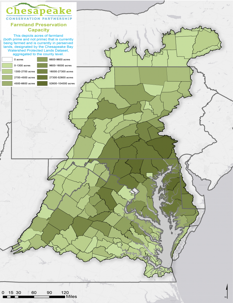
Where is the capacity to support future farmland conservation? How is it concentrated? What does this suggest about where future farmland protection might be most likely or most effective?
This map illustrates where capacity for implementing farmland protection currently exists, based on past accomplishments. Specifically, this depicts the relative magnitude of farmland that has been protected by county. Darker shading means a higher proportion of existing farmland has already been protected.
This is just one proxy for illustrating capacity. It is not perfect, as it is derived from past actions. Circumstances may have changed over time.
For more information and to explore the map featured below further, please visit https://www.landscope.org/chesapeake/chesapeake_map_layers/conservation_priorities/chpk_FarmlandPreservationCapacity/27806/