
History of Conservation in the Chesapeake

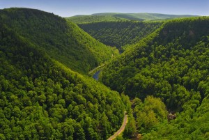
The Chesapeake Bay, the largest estuary in North America extends more than 11,000 shoreline miles and encompasses 64,000 square miles in 6 states and the District of Columbia. The watershed – the Chesapeake Bay, its major tributaries, and the surrounding landscapes – has long been regarded as an ecological, cultural, and recreational treasure of national and international importance.
Efforts to conserve the Chesapeake landscape have evolved over time in a series of phases. For thousands of years, the Chesapeake Bay watershed was a land of abundance, rich history, and natural beauty. The native peoples of this watershed managed and conserved this land of abundance successfully for thousands of years. When the first Europeans arrived in the Chesapeake Watershed, they were amazed by the abundance of wildlife. They found a land teaming with seemingly endless wildlife and rivers choked with fish. Passenger pigeons clouded the skies overhead and old forests produced crystal clear water in the wildlife-filled rivers. Many of the original peoples on this continent had thousands of years of deep connection to this land. However, within a couple of centuries, most of the Native Americans were forced off their land, most of the Bay watershed had been cleared which removed the natural filters that were the liver and kidneys of the region’s natural ecosystem, much of the history of the area was lost, and the ecology of the Chesapeake Bay was on the brink of collapse.
A period of rapid deforestation in the late 19th century resulted in the growth of national and state forests throughout the region. From the 1930s through the early 1960s, the creation of new state and federal public parks largely characterized the next phase of conservation. From Shenandoah National Park in 1935 to dozens of new state parks in Virginia, Maryland, and Pennsylvania, many took their form from work by the Civilian Conservation Corps during the Great Depression.
A new phase of conservation began in the 1960s and continues today. Several factors characterize this phase: (1) innovative land protection initiatives at the state level; (2) the growth of the nonprofit land trust movement; and (3) the development of collaborative partnership landscape conservation efforts.
The Chesapeake region has triggered state‐level innovations in land conservation for decades. Virginia Outdoors Foundation, established as a public body in 1966, has protected more than 880,000 acres through conservation easements, many facilitated by the state’s groundbreaking Land Preservation Tax Credit Program. Maryland’s Program Open Space, established in 1969 as a dedicated funding source for land conservation, has successfully protected over 415,000 acres. Another nationally renowned leader, the Pennsylvania’s Farmland Preservation Program, has protected over 630,000 acres since 1989.
This phase also experienced a surge in the growth of land trusts in the region, mirroring a similar pattern nationwide. Today, more than 170 land trusts exist in the Chesapeake watershed. These include large state chartered institutions like the Virginia Outdoors Foundation and the Maryland Environmental Trust, but also entirely independent organizations often structured around particular geographies, such as the Eastern Shore Land Conservancy, which has protected over 65,000 acres.
The past several decades witnessed an evolution of multiple permutations of collaborative partnership conservation efforts. Beginning in the 1980s, state and national heritage area movements drew together cultural tourism and conservation in an intentional and strategic way. Pennsylvania and Maryland led the effort by focusing on distinctive large landscapes through state heritage area programs created in 1989 (PA) and 1996 (MD). Pennsylvania also established a Conservation Landscapes Initiative in 2005. Congressional designation of national heritage areas—driven by local demand—has fueled this as well. The Shenandoah Valley Battlefields National Historic District was established in 1996 and the 3.4 million acre Journey Through Hallowed Ground National Heritage Area and Scenic Byway in 2006, both of which are entirely within the Chesapeake watershed. Federal agencies remain key partners and leaders in many of these conservation collaborative partnerships.
 The US Fish & Wildlife Service embraced landscape level partnerships through the Rappahannock River Valley National Wildlife Refuge (NWR), established in 1996, and the expansion of Blackwater NWR in the Nanticoke River watershed.
While the National Park Service began managing lands in the Chesapeake region in the 1920s and now holds 55 park units in the watershed, recent decades have heightened the focus on collaborative conservation models. These efforts include key roles in heritage areas, along with the national trail system and new park units. The Captain John Smith Chesapeake National Historic Trail (2006), which extends along shorelines and multiple rivers throughout the Chesapeake watershed, focuses in part on collaborative conservation of evocative landscapes along the trail route, while the 560‐mile Star-Spangled Banner NHT commemorates the Chesapeake campaign of the War of 1812. Similarly, collaborative conservation has long been a part of sustaining the Appalachian National Scenic Trail.
The designation of Fort Monroe National Monument in 2011 and Harriet Tubman Underground Railroad National Monument in 2013 created new NPS units that directly involve multiple partners. Concurrent with the growth and evolution of landscape conservation in the region, the Environmental Protection Agency and the Chesapeake Bay Program have spearheaded a three decade effort to address water pollution in the region. In 2000, the program formally recognized the importance of land protection to water quality, setting a goal of protecting 20% of the watershed by 2010. That goal was attained, with an average of 125,000 acres protected each year between 2000 and 2009, mostly through state and local land protection programs and nonprofit land trusts. By 2010, 7.8 million acres in the watershed were permanently protected.
After the attainment of the 2010 goal, the 2014 Chesapeake Bay Watershed Agreement set goals to conserve an additional 2 million acres by 2025, and 30% of the entire watershed by 2030. These goals were similarly adopted by the Chesapeake Conservation Partnership. In 2015 and 2016, the Partnership worked to incorporate more goals focused around farms, forests, habitat, human health, and heritage. In 2017, a parcel of land along Fones Cliffs was conserved and presented back to the Rappahannock Tribe. Further partnerships among governments and organizations like The Conservation Fund, The Nature Conservancy, and the Chesapeake Conservancy led to increased protections in 2018.
Over the last few years, the Chesapeake Bay watershed has also garnered international attention through collaborative efforts to return lands to the tribes and peoples that have protected it for thousands of years. For example, on April 1, 2022, at an event with U.S. Department of the Interior Secretary Deb Haaland, the Rappahannock Tribe announced that it had re-acquired 465 acres at Fones Cliffs, a sacred site to the Tribe located on the eastern side of the Rappahannock River and restored its original name of Pissacoack. “We have worked for many years to restore this sacred place to the Tribe. With eagles being prayer messengers, this area where they gather has always been a place of natural, cultural and spiritual importance,” said Rappahannock Tribe Chief Anne Richardson.
2023 saw the release of updated Protected Lands Indicator data from USGS and a more accurate look at the progress toward 2025, 2030, and 2050 goals, as well as the adoption of a goal in Maryland to protect 40% of the state by 2040.