
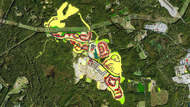
On a satellite image, colored portions made using the new data show land use change between 2013 and 2018. (Image courtesy of U.S. Geological Survey)
By Rachel Felver
Innovative technology continues to make advancements for Chesapeake Bay restoration through a new land use/land cover data. The Chesapeake Bay Program, in collaboration with the Chesapeake Conservancy, U.S. Geological Survey and the University of Vermont, is pleased to announce the release of the Very High-Resolution Land Use/Land Cover and Change Data.
The new dataset includes a more detailed land use/land cover classification with enhanced technical and scientific information that was not previously available in prior data products. Updates include the 2013-14 data, new 2017-18 data, and the change data from 2013-14 to 2017-18.
This is the largest amount of open data at this scale that has ever been made available and it’s free for anyone to use. To learn more about what is included in this new data set and how this tool can be used, visit the Chesapeake Bay Program’s Website.
Lightning Update is a regular communication of the Chesapeake Conservation Partnership. Any opinions expressed are those of the authors and do not necessarily reflect positions of the Partnership or member organizations.
To share a success story, news, or important event, send your information to:
Support for the Chesapeake Conservation Partnership is provided by:
National Park Service Chesapeake
EPA Chesapeake Bay Program
USDA Forest Service
Pennsylvania Department of Conservation & Natural Resources
Maryland Department of Natural Resources
Virginia Outdoors Foundation
US Fish & Wildlife Service
Chesapeake Conservancy
The Chesapeake Conservation Partnership is co-convened by:

")