
Written by: Louis Keddell Geospatial Program Manager Chesapeake Conservancy’s Conservation Innovation Center
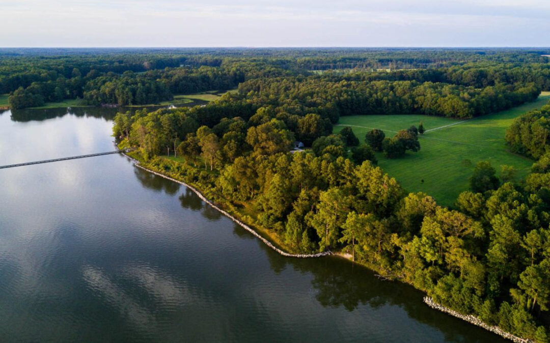
The Chesapeake Bay Program (CBP) recently announced the release of the official 2022 protected lands dataset, which combines the best available protected lands data from state and local sources in combination with the national Protected Areas Database of the United States (PAD-US). According to the new dataset, the Chesapeake Bay watershed has conserved roughly 22% of the total land area within the watershed or 9.1 million acres. CBP defines protected lands as “lands permanently protected from development, whether by purchase or donation, through a perpetual conservation or open space easement or fee ownership for their cultural, historical, ecological or agricultural value” (Chesapeake Progress). Over the last dozen years, this region has protected an average of nearly 130,000 acres a year thanks to the collective efforts of partners and willing landowners, nonprofits, tribes and local, state and federal agencies.

Map of the Chesapeake Bay Watershed
The Chesapeake Conservation Partnership has adopted President Biden’s executive order to protect 30% of lands by 2030 (30×30) to better tackle the climate crisis, ecosystem degradation and biodiversity loss. If the average protection rate were to continue, we would reach the Bay Program’s 2025 goal to protect 2 million acres since 2010, but the final tally for land conservation would fall a couple of million acres short of the 30×30 goal. The current pace of conservation since 2018 has slowed, and with about seven years left until 2030, annual land conservation rates will need to increase dramatically—by 350%—to reach the 12.2 million acre goal by 2030.
Reaching the watershed’s 30% land protection goal will require new and innovative partnerships and policies. The Chesapeake Conservation Partnership (CCP) is working with federal, state and local entities to identify multiple paths forward to success while reducing barriers where possible. The CCP will primarily support a number of broad focus areas:

Community buy-in for 30%
Conservation in our watershed is done through voluntary efforts working closely with landowners and partners involved at multiple levels to conserve land from development across the District of Columbia and the six states that comprise the watershed. Partners protect land for many reasons, from heritage to local food production to human health. The watershed community must work together to adopt this goal to collectively preserve the little over three million acres remaining.
While the largest tracts of land appear to be the obvious answer for a 30×30 goal, much of the watershed community lives in urban areas where small properties often characterize land ownership. The CCP supports an inclusive and equitable approach to land conservation that encourages the enjoyment of conserved lands for all watershed communities. As shown in the CCP Green Space Equity Tool, many under-resourced and/or underserved communities live in urban areas with little access to green space. To conserve lands in perpetuity for the enjoyment of this and future generations across the watershed, the partnership must acknowledge the relatively smaller but just as meaningful impact that conserving lands in under-resourced and/or underserved urban areas will have on the communities living there. Encouraging future stewards and an appreciation of nature across geographies benefits different communities and may also build broader public support for policies that ultimately shape and enable land conservation efforts across the watershed.

Chart of Unprotected Land by County: New York and Pennsylvania
Empowerment through data
The CCP seeks to empower member organizations through high-resolution land conservation-focused GIS data analyses and tools. Through partnerships with the Chesapeake Conservancy’s Conservation Innovation Center and the CBP’s GIS team, the CCP aims to lay the groundwork to better understand the lay of the land when it comes to conservation patterns, remaining unprotected land opportunities (both large and priority small tracts) and those at risk of future development. By accounting for and visualizing land protection opportunities in relation to potential development risk and importance to valued habitat, climate resilience, community priorities (farmland, cultural heritage, etc.) and public health, partners will be able to make more informed decisions on where to focus landowner outreach and education, strategize with local conservation networks and secure the funding necessary to conserve priority lands before they are converted to developments, commercial sites or impervious services. Many local organizations lack the technical expertise and capacity to generate the maps and numbers needed to make a more compelling funding proposal and strategy. The CCP aims to work with the conservation community to better fill that gap so all partners, large and small, can contribute meaningfully to an equitable and inclusive 30×30 goal.

Chart of unprotected land by county: Virginia and West Virginia
Image credit:
- Library of Congress Map of the Chesapeake Bay Watershed- 1984
- Chart of Unprotected Land: Maryland and Delaware – Alicia Sabatino
- Chart of Unprotected Land: Pennsylvania and New York -Alicia Sabatino
- Chart of Unprotected Land in Virginia and West Virginia- Alicia Sabatino
Lightning Update is a regular communication of the Chesapeake Conservation Partnership. Any opinions expressed are those of the authors and do not necessarily reflect positions of the Partnership or member organizations.
To share a success story, news, or important event, send your information to:
Support for the Chesapeake Conservation Partnership is provided by:
National Park Service Chesapeake
EPA Chesapeake Bay Program
USDA Forest Service
Pennsylvania Department of Conservation & Natural Resources
Maryland Department of Natural Resources
Virginia Outdoors Foundation
US Fish & Wildlife Service
Chesapeake Conservancy
The Chesapeake Conservation Partnership is co-convened by:

")